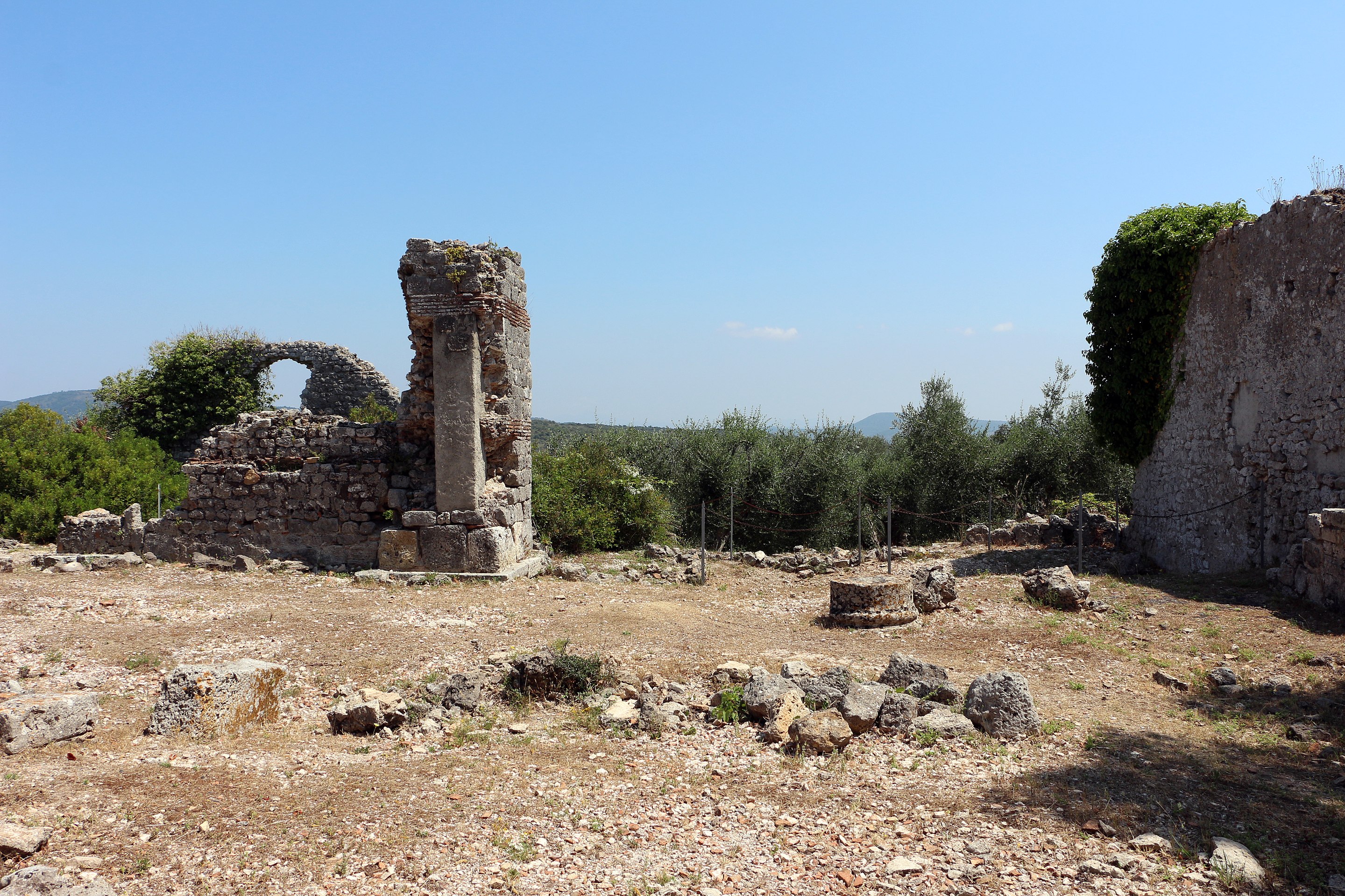
Cosa was a colony of Latin law, founded in 273 BC. on the coast of southern Tuscany. Its name probably derives from that of an ancient Etruscan centre, Cusi or Cusia, identified in modern Orbetello. It stood on the rocky promontory of the current Ansedonia, located at 114 m asl, and today the site falls within the municipal territory of Orbetello.
The area includes two hills, one to the east (Collina orientale) and one to the south (Arce), in a strategic position both for the control of the sea and land traffic.
Republican age
Cosa was deduced in 273 BC as a Roman colony of Latin law in Regio VII Etruria, following the defeat of the Etruscans Volsinii and Vulci in 280 BC. At the time of urban planning it was decided to plant the Forum, intended for civic and political activity, near the saddle that divided the Arce (the city’s acropolis) from the Eastern Hill. The construction of the main infrastructures dates back to this first phase, including the walls, the gates, the roads, the sewers. However, despite the strategic position, the colony was not lucky and needed a new deduction. This happened in 197 BC. and started the moment of maximum development of the site, with a thriving urban activity, which lasted until the beginning of the 1st century BC. In this period Cosa was able to fulfill the functions for which it was founded: military-strategic control (both over the newly conquered territories and over the sea from which the Carthaginian threat could arrive), the economic management of the territory to which it belonged, but also the landing function for maritime trade. During the first half of the 1st century BC, however, Cosa was plundered and destroyed under still unknown circumstances, remaining practically abandoned until the Augustan age. The difference is clear with the condition of the surrounding ager which, instead, experienced its maximum economic development at this very moment: large landowners began an intense exploitation of the territory for agricultural, oil and wine production, clearly evident in the remains of the nearby Villa Seven windows.
Imperial Age
Under Augustus, Cosa was partially rebuilt: the areas of the Forum and the Arce were restored, while only some areas around the Forum show a phase of occupation. Probably the fulcrum of the economy was based on fish farming, certainly practiced in the lagoon. With the imperial era, starting from the middle of the 1st century AD, the territory of Cosano became part of the imperial possessions of the Domitii Enobarbi, family of the emperor Nero. The restructuring interventions in the Forum are owed precisely to the will of the latter, including the transformation of the ancient Basilica into an odeum. Later, however, already in the II century AD. there was a new phase of abandonment.
Late Imperial Age
At the beginning of the 3rd century AD, under the Severian dynasty, the city showed a recovery. The establishment of the Res Publica Cosanorum, whose identification with the city of Cosa is still debated, bears witness to the desire to revive the fortunes of the center and its territory, the Ager Cosanus. Abandoned again at the end of the 3rd century, for the 4th century AD. a What minimal traces of occupation and signs of public neglect are documented. The port also saw the cessation of maintenance work. A sort of caesura emerged between the Roman Cosa, now in decline in the 3rd century, and the Byzantine Ansedonia, reborn from the ashes of the former at the end of the 5th century AD. The story of Rutilio Namaziano (Rut. Namaz., De Reditu di lui, 1.285-290) offers us an image of Thing composed only of ancient deserted ruins, mentioning the legend of its abandonment due to an invasion of rats.
Medieval Age
Cosa reached its minimum extension between the 4th and 5th centuries AD, when there was an almost total depopulation. Nothing is known of the preservation of public buildings after the renovations of the 3rd century AD. Following the Severan restoration, the interventions seem limited to the use of the remains of the older structures. In the 6th century AD traces from the Forum are attributable, where a church was planted on the ruins of the ancient Basilica. The presence of an ecclesiastical structure and the contemporary attestation of two Byzantine officials defined Cosa-Ansedonia as a civitas. During the early Middle Ages there was a new prolonged abandonment of the site. A necropolis referring to the Lombard phase has been connected to some huts planted on the ancient insulae. The last early medieval structures investigated in the eastern area of the city are related to a castle made of wood and earth. Two new ecclesiastical buildings date to the period between the end of the 9th and the middle of the 12th century, one in the Forum, on the ruins of the ancient Temple B, and one on the Arce. Between the 9th and 11th centuries A.D. the Cosano territory was given in cession to the monastery of S. Anastasio ad aquas salvias. Starting from the 12th century AD, the territory of Cosa was subjected to papal authority; subsequently, from the XIII century, it passed first to the Aldobrandeschi family and then to the municipality of Orvieto. Finally, in 1329, a Sienese army attacked and destroyed the fortifications of Cosa.
Urban Planning
City wall
When the colony was founded, it was necessary to guarantee its safety by erecting a massive boundary wall. This circuit, about 1500 m long and partially restored by order of the Superintendency, enjoys a remarkable state of conservation. In addition to the external wall perimeter there is also a stretch of wall to delimit the Arce. The masonry technique used is the polygonal work of the third way, characterized by squared blocks worked on the exposed face that adhere perfectly without having to resort to binders. Along the walls there are eighteen towers, placed at irregular intervals. There are three entrance gates to the city, positioned in relation to the internal and external road network: the North-West Gate (Porta Fiorentina, current entrance to the site), the North-East Gate (Porta Romana) and the South-East Gate ( Marine Gate). The doors share the same propylon structure, a double locking system with internal compartment; the use of gate valves is documented by the furrows still clearly visible along the jambs of Porta Romana. The entrance to the Arce, on the other hand, was through an unfortified passage between the walls delimiting this area. At the western corner of the Arce there was also a postern, then closed up in the early Middle Ages with discharges of ancient material.
road system
Much of the ancient road network is still buried, as only a small portion has been excavated. The road organization was at the basis of the urban layout of the city: a dense network of roads intersected at right angles delimited rectangular blocks.
The Forum has a rectangular plan; the main entrance was on the north-western side and in ancient times it must have had a monumental appearance thanks to an access arch with a triple archway, of which there are still remains of collapsed walls. It played a particularly important role since here, on its northern side, the main civil and religious buildings stood: the Basilica, the Curia-Comitium complex, Temple B. Private buildings and tabernae overlooked the other sides. The first buildings date back to the foundation period, such as the Comitium and the Carcer, but the definitive arrangement of the square will take place only in the middle of the 2nd century BC.
Only a few traces remain of the Basilica today, mostly pertaining to the later phases of the building. Its construction dates back to around 140 BC. and was the final addition within the architectural enclosure of the Forum, following the completion of the Curia and Temple B. The structure has a rectangular plan with sixteen internal columns that outlined a large central nave and a surrounding ambulatory, overlooking the Forum with a six-column portico. In the center of the back wall, however, there was a niche that housed a court. It is possible that statues were displayed inside the structure, given the discovery of travertine slabs for the support of pedestals. The structure must have had a double-sloping wooden roof with trusses. In correspondence with the central nave there was probably a colonnaded upper level, testified by remains in situ which survived the collapses. Under the building there are two large cisterns dug into the rock: one dates back to the birth of the colony, the second is later. The Basilica was erected at the same time as the first great basilicas of Rome, and is the oldest so far attested in the colonies. Its prototype is therefore to be found among the first Roman basilicas, still poorly documented; moreover, its structure corresponds to the type of building described by Vitruvius in his “De Architectura”. In the middle of the 1st century AD. the interior of the Basilica was transformed into an odeum, a theatrical space. The discovery of an inscription that recalls the restructuring operations has allowed us to attribute the intervention to the will of Nero. Around 51 AD. in fact, a violent earthquake occurred and Nero’s intervention, therefore, would have remedied the damage caused. The Odeum, quadrangular, rested on rectangular piers which replaced the lower columns of the nave, so as to ensure stability for the elevation of the stage and seats for spectators. Between the end of the III and the beginning of the IV century AD. Cosa fell into disrepair and with it the Odeum. During the sixth century AD. on the ruins of the structure, along its northern side, a church was built. For the long sides the construction p was usedexisting, while the short sides were built from scratch. In the south-eastern portion, however, two ovens and two rooms, probably houses, were built.
The Comitium and the Curia
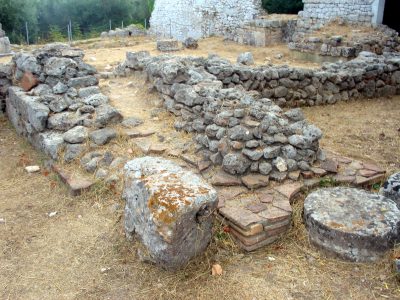
Next to the Basilica, to the south-east, the ruins of the Curia-Comitium complex are still clearly visible, responsible for the activities of the magistrates and the assembly of the inhabitants. The Comitium is characterized by the typical uncovered circular staircase which was accessed from the Forum; the Curia, on the other hand, was a covered room accessible from the top of the steps of the Comitium.
The complex was built soon after the city was founded. The Comitium had a rectangular layout, with access to the Forum located in the South-West. In addition to the stone steps of the cavea, rows of wooden steps must have been arranged against the perimeter walls. These steps were essential, at least in the North-East, to access the Curia, originally limited to a single central room. The Curia was a small structure built on two floors. The upper floor, accessible from the Comitium, was the actual Curia, while the lower floor was possibly an archive.
With the next phase (third quarter of the 3rd century BC) the steps of the Comitium, probably eight in total, were finished in stone and the entrance was monumentalised. It was calculated that up to 596 people could be accommodated. In the circular space in the center of the auditorium it is possible there was an altar. After the arrival of new settlers in 197 B.C. the Curia was enlarged: two new rooms were built on the sides of the already existing central body, each accessible from the Comitium. The actual Curia remained in a central position, the North-West room perhaps had the function of Tabularium (archive), while the South-East room probably housed the offices of the magistrates. The Comitium and the Curia maintained this arrangement for most of the colony’s history. During the 2nd century AD. a Mithraeum was created in the basement of the South-East room of the Curia. Along the walls, the typical lateral earth platforms and the bases for the statues – perhaps – of Cautes and Cautopates are still visible; the masonry altar was located at the back of the room. Following the long periods of abandonment of the city, the complex lost its original function and was probably abandoned. The last changes occurred in the V-VI century AD. when Cosa revived for a short time and three new routes were created to reach the Forum and the Arce (maintenance of the ancient road network had ceased some time ago). Of these, the one that connected the Arce to the square crossed the Forum transversally passing over the ruins of the Comitium, cutting off the ancient steps with a wall built to delimit the street level.
Temple of Concordia or Temple B
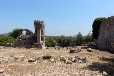
Next to the remains of the Curia-Comitium complex there are traces of the forensic temple of the city. Known as Temple B, the cult practiced here was that of the goddess Concordia. The temple was founded around 175 BC, on a polygonal base, and was characterized by a single cell with two rows of two columns on its front (pronaos). It is thought that the temple was built on previous remains, a hypothesis that would justify the particularity of the decentralized altar in front of the sanctuary. Between the 10th and 11th century AD a Christian church was built over the ruins of the Temple.
Architectural and pedimental decoration
Among the finds recovered, there are numerous fragments pertaining to the architectural decorations of the structure, which it was possible to largely reconstruct. All the characteristic elements of the Etruscan-Italic temples are present, i.e. antefixes, strigilated simas, openwork rampant cornices and cladding slabs. Between the end of the 2nd century BC. and the beginning of the 1st century BC. some changes were made to the decoration. A reconstruction of the architectural decoration of Temple B is exhibited in the National Archaeological Museum of Cosa. The pediment of the temple must have been populated by clay sculptures of which numerous fragments have been found and of which it is possible to reconstruct some of the characters present: a bearded man with a Phrygian cap, dressed in a tunic and boots; two children, two draped women, and other male and female figures. It is difficult to make hypotheses for the identification of the characters, but it is likely that the scene was of a mythological nature. Among the finds there are also decorations believed to be part of a frieze with carts and horses and part of the figura of a long-robed charioteer, therefore it is possible that a frieze ran along the wall of the cell, or that these elements decorated the altar of the temple or the base of the cult statue.
Jail
Next to the Temple of Concord is a structure interpreted as a Carcer. The identification is due to the peculiarity of the structure, organized on two levels, one of which is underground and interpreted as a cell.
Sacellum of Liber Pater
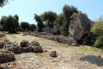
Opposite the access to the Forum, in the place that was the ancient south-eastern entrance, a sacellum dated to the 3rd century AD has been identified. Based on the discovery of an inscription now kept in the Museum, which bears the name LIBER in reference to Liber Pater, the hypothesis has been proposed that the sacellum was dedicated to him. The peculiarity is that it was set up by reusing previous materials belonging to other contexts of the city.
The Arc
Square Thing
The denomination of “Cosa Quadrata”, in clear reference to the debated Roma quadrata handed down by sources, was attributed by American archaeologists to the evidence relating to a cultic use of the Arce as early as the 3rd century BC. Among these first evidences there would be a natural fissure in the rock 2/2.50 m deep, which at the time of discovery yielded traces of ash and charred vegetables, interpreted as the remains of offerings placed for ritual purposes, and a square limestone platform of about 7.40 m per side. Its positioning on the highest point of the Arce and its proximity to the aforementioned cavity support the hypothesis that a cultic significance should also be attributed to this evidence. It is no coincidence that the central cell of the temple that will rise on the Arce, the Capitolium, will be built right above these two previous testimonies, representing a continuity with the religious past of the colony.
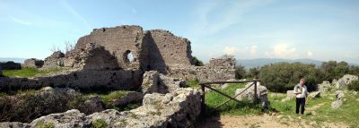
Temple of Jupiter
The Temple of Iuppiter is the oldest sacred building built on the Arce, no longer visible on site; its construction dates back to the years 240-220 BC. in the area south of the Capitolium. Unfortunately, the data are not sufficient to be able to understand what the plan of the building was, and the same orientation – proposed with the front facing the processional way – is hypothetical. It is thought that this first temple resembled, in size, the future Temple D. Its destruction would be attributable to a fire during the 1st century BC. The identification of the cult was proposed on the basis of the discovery of decorative material including depictions of Minerva and Hercules. However, the deity worshiped is far from certain. Of the sculptural decoration hypothesized as pertaining to the pediment, only fragments remain, preserved and exhibited in the National Archaeological Museum of Cosa, including a male torso dressed in a short tunic and cuirass, half the size of the real one. Other fragmentary figures have also been found, but of smaller dimensions.
Temple of Mater Matuta or Temple D
The remains of the small sacred building are still clearly visible. Known as Temple D, it has been interpreted as the seat of the cult of Mater Matuta, but its “marginal” position on the Arce denotes a secondary role. The structure, dated to 170-160 BC, stands on a low polygonal podium and was originally equipped with a single square cell measuring 9 x 9 m with four columns of the Tuscan order. Access was via a flight of steps in front of the temple, where there was also the altar, of which only the foundations remain. A huge renovation presumably took place at the beginning of the 1st century BC, when the decoration was renewed and four new columns were erected in an advanced position compared to the pre-existing ones. Furthermore, two doors were built as a continuation of the side walls of the cell, until they incorporated the two original external columns, while the central ones were dismantled. These operations were conducted simultaneously with the construction of the Capitolium.
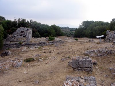
Architectural and pediment decoration
The original decoration included numerous terracotta elements (covering slabs, antefixes, simes and openwork rampant cornices), then renewed during the first quarter of the 1st century BC. Very few traces remain of the pediment sculptures. The identification of the cult with that of Mater Matuta was advanced on the basis of the discovery of a standing female statue anddraped, with long wavy locks; fragments of a frieze with dolphins – animals present in the myth linked to the goddess – would support the hypothesis. Further confirmation would come from the discovery of two inscriptions which mention the presence of a matronly boarding school in Cosa.
The Capitolium is the arrival point of the processional way P. Of the temple there are still notable remains above all for their elevated conservation (up to 9 m in height). The structure, measuring 20.7 x 25.9 m, was erected around 150 BC. on a terrace with polygonal facing; access was via a tuffaceous stairway that led to the podium, to the pronaos. The podium, in this case, is only apparent, since in reality the stones are only placed against the external walls of the temple. There were three cells and the colonnade on the front had a first row of four columns and a second row of two between the doors. It has been hypothesized that the colonnade reached almost 7 m in height, out of a total of 18 m of the entire building. The presence of three cells is the reason that led to hypothesize the cult of the Capitoline triad. The pronaos, very deep, has a peculiarity: in front of the cells is a long and deep cistern with rounded short sides. On the terrace, in front of the temple, was the altar, which however did not have the same orientation as the sacred building. A change of orientation in line with the structure of the Capitolium will take place only later, in the late 1st century BC, when the architectural decoration was also renewed. Numerous Campana slabs have also been attributed to this last phase, decorative slabs that were to be fixed to the walls of the Capitolium probably to replace missing or damaged cladding slabs. A series of structural operations also refers to this renewal: the sacred area was expanded with the demolition of the old access stairway to put a new one before the terrace of the temple. Furthermore, a high wall was erected which enclosed and screened the stairway, open only in the vicinity of an entrance arch. Starting from the second century AD, following the crisis of the colony, the Arce appears abandoned. There are no traces of attendance even later until, in the sixth century AD, it became the site’s main point of interest, together with part of the Forum. A series of structures were built between the Temple of Mater Matuta and the Capitolium, interpreted as a granary, barn and stable. Later, probably in conjunction with the creation of a line of defensive Byzantine castra against the Lombards, the Arce was equipped with its own fortifications, taking up part of the ancient walls, and became a strategic lookout point. The later traces of attendance concern the construction of a church, with its cemetery, around the 9th-10th centuries AD.
Architectural and pediment decoration
The temple had a remarkable architectural decoration in terracotta (covering slabs, lateral antefixes, simas and openwork rampant cornices), which over the course of time underwent numerous restorations and remakes. It was mainly the modifications of the mid-1st century BC. to have brought the most consistent innovations. Of the sculptural decoration of the pediment it is possible to distinguish between an original decoration and a later one, dated to the middle of the 1st century BC. The difference was in the size of the figures. As regards the first group, the presence of at least fourteen statues has been reconstructed. Of these, only five were natural size, while the others were three-quarters, half and one-third life size. Some fragments conserved in the Museum belong to this series. Figures of uniform height have been hypothesized for the second group. The fragment of a female hairstyle with diadem, preserved in the Museum, belongs to this group. The subject of the pedimental decoration of the temple has been hypothesized to be a gathering of divinities, including Jupiter, Juno and Minerva.
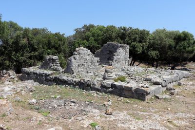
The East Hill
The Eastern Hill is not easily accessible and is located outside the visit route. During the first half of the 2nd century BC. the upper portion of the hill was leveled for the purpose of building a sanctuary (Temple E). It is probable that the area had previously housed domestic buildings. However, very few traces of this ancient frequentation remain. However, some structures dating back to a later period have been identified. Wooden constructions (traces of post holes) and others with sunken-floored buildings have been dated to the 11th century. Subsequently, the area was designedstrongly fortified, first with earthworks and then with the construction of a tower and a system of external fortifications, at the center of which was a village. In the 12th century, a tower equipped with a cistern and a circular structure interpreted as a base for a catapult or trebuchet were built inside these fortifications. The cistern was then reused as a prison, a hypothesis suggested by the graffiti on the walls, one of which indicates the date of 1211. In 1203 the castle passed to the Aldobrandeschi family, and was later destroyed by the Sienese in the conflict against Orvieto in 1329.
Temple E
Very little is known about this sacred building located on the top of the Eastern Hill and even the cult practiced is unknown. Built on a terrace overlooking the sea, it must have been quite small. It was probably part of a larger sanctuary area. Due to the subsequent leveling of the area and following the intense use in medieval times, the remaining traces of the temple are very scarce. The construction technique is similar to that of Temple D, with a podium made with large isodomic limestone blocks, mostly squared. Unfortunately it is only possible to trace the external dimensions of the structure, 6.25 x 11.25 m. The dating to the Republican era (mid-2nd century BC) was proposed on the basis of a Greek-Italic amphora fragment datable to the 2nd century BC. found inside the podium of the temple, and on the basis of the comparison of the architectural terracottas with those of the original decoration of the Capitolium (mid-2nd century BC) and with those of Temple B from the same period. The cult building survived perhaps only until 70 BC, when the city was hit by a heavy crisis and after which this area does not seem to have been affected by the Augustan reconstruction.
Water infrastructure
Cistern
Water supply has always been one of the biggest difficulties for Cosa. For this reason, every building in the colony, whether public or private, had its own system of cisterns and channels for the collection and redistribution of rainwater. The cisterns identified within the perimeter of the city, in fact, are very numerous. Near the Forum, in its eastern corner, is the site’s oldest cistern: it dates back to the 3rd century BC, when, at the time of the colony’s foundation, an initial solution was needed that would provide a substantial water reserve. The structure, which later also supplied the nearby thermal plant, had a public character, as suggested by its considerable size: a maximum capacity estimated at 750,000 liters has been calculated. Originally open to the sky, the cistern was only given a wooden cover at a later time. This rested on four large pillars placed in the center, whose rectangular bases are still clearly visible. 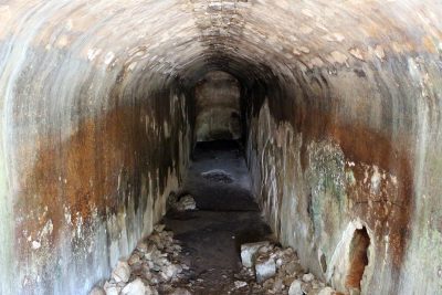
Thermal plant
The Cosa thermal complex is located northwest of the Forum, between O, N and 5 streets. Initially studied by Frank Brown in the 1950s, it has been under investigation since 2013 by Florida State University, Bryn Mawr College and the University of Tübingen. The exact planimetry, the distribution of the rooms, the period of use are yet to be defined. From the stratigraphy and the finds it is assumed that the baths were already in operation in the late Republic and then in the imperial era, in particular with the Augustan rebirth, and between the Trajan and Antonine ages. The baths, which could be accessed from the W road, were fed by the cistern system of the colony, also taking advantage of the natural slope of the land from south to north; they therefore represent a great engineering test. Most of the water arrived through a tunnel that connected the baths to the public cistern of the Forum. The most imposing structure is certainly the high wall in opus incertum which supports a rectangular basin covered with cocciopesto; the system for raising the water up to this tank is still being studied. The environments investigated can be interpreted according to the Roman scheme of the frigidarium, tepidarium and calidarium, and the annexed rooms such as latrines, changing rooms and gyms. The water was heated in the praefurnium and transported to the alveus (a pool) and laconicum (sauna) by a system of tubules. Not far from the raised basin there is a circular room in opus latericium, interpreted as a laconicum (sauna) on the basis of what appears to be a hypocaust covered above by a mosaic floor.
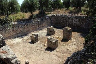
the houses
Diana’s house
The Atricium Building V, more commonly known as Diana’s house, is located on the south-west side of the forum. The republican age structure (first half of the second century BC) is outlined as a typical Roman house in Atrium: the entrance was flanked by two tabernae, one perhaps intended for the sale of wine (given the discovery, in the discharge of the shop, of Cups and bottles), the other perhaps used for the cooking and sale of food (given the high number of dishes, glasses and tegami). From the entrance it was accessed directly to the rectangular atrium, equipped with a central Impluvium. On the right side of the atrium there were two cubicula while in the rear there were two Alae (lateral environments). Following there were: the tablinum (representative hall) and the triclinium. The garden was perimeter from a high wall, in a way – perhaps – to avoid visibility from the street. The house was destroyed at the beginning of the first century BC and was completely reconstructed only in the Augustan period, probably towards the last quarter of the first century BC. The reconstruction of the walls left the original Pisé only in the slightest part, replaced by plastered and painted walls; The renovation of the flooring is also documented. However, the most significant aspect is the architectural change of some rooms of the building, in particular the triclinium of which the back wall was opened thus destining it to summer dinners; The winter dining room was obtained from the union of two other rooms. In addition, another environment that was transformed into a small sacred place dedicated to imperial cult. Between 50 and 60 AD, a newsstand leaning against the perimeter wall of Northwest was built inside the garden, with the appearance of a miniature temple: three steps between two columns led to a small cell with the statue of worship of the goddess Diana, hence the name given to the house. On the architrave was probably an inscription, preserved in the National Archaeological Museum of what: the text could refer to a Via Dianae, perhaps the processional street that from the forum, skirting Diana’s house, saliva to the end (where the Temple of Mater Matuta would have also hosted Diana’s cult), or could refer to a passage from the road to the garden guaranteed by a staircase, at the west corner of the garden itself. During the third century AD The house poured into a state of abandonment, but the presence of ceramic fragments in the landfills of the materials attest to the attendance of the area even in the late ancient period (IV-VI century AD).
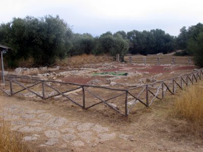
House of the Treasury
The home, on whose ruins the archaeological museum was built, owes the name to the discovery of a treasure of 2004 coins. These were hidden under the pantry plan, perhaps to preserve them from a looting. Of the treasure, a small group of coins is from the end of the second century BC, while the large majority belongs to the first thirty years of the first century BC. The money later dated 74-72 BC. And their excellent conservation indicates that they did not circulate much. The date of texture – and therefore the final phase of the republican thing – can be set around 70 BC. In addition, the discovery of two black paint pots with letters Q. FVL. Graffiti on the bottom made it possible to report the belonging of the home to this Quintus Fulvius. The Domus dates back to the first century BC But it was in turn built by renovating and exploiting the remains of previous homes. It was characterized by three rooms (kitchen, pantry and bathroom) and a large environment, subsequently divided into two. Fragments of the parietal decoration were found in the first style; Opus Signinum Opus Signinum (more commonly known as cocciopesto) decorated with white cards was brought to the floor decoration of the new environments. Based on the treasure, buried between 72 and 71 BC, and the affinities with the house of the skeleton, the construction of the House of the Treasury is located between 90 and 80 BC.
Skeleton House
In the eastern block of the same isolated of the House of the Treasury, the house of the skeleton was brought to light, so called for the discovery, in the strata of cistern accumulation, of the skeleton of an adult male individual, perhaps throwing yourself during the period that led to destruction of the city around 70 BC The house is divided around an atrium in the center of which there is the impluvium, the presence of which suggested that a compluvium (opening in the roof at the impluvium) should be there, of which, however, no traces have been found. Under the atrium there is a cistern. Therestructure included a culina-lavatio sector (kitchen and bathroom areas); there is also probably a second kitchen and a pantry for groceries; nearby is a room which, on the basis of the discovery of loom weights, was probably intended for women’s work. Next to the entrance was a small bedroom. Then there was a service area, perhaps a shelter for animals, and stairs leading to an upper floor, the extent of which is unknown. There were also two exedrae, one for the winter months (hiberna), the other for the summer ones (aestiva). From the exedra aestiva one reached the covered triclinium and the portico, which led to the large garden and the summer triclinium. Most of the rooms in the Casa dello Skeletro have floors in opus signinum with a geometric design, as in the aforementioned Casa del Tesoro. Part of the wall decoration is also preserved. The dating of the construction and subsequent destruction of the Casa dello Skeletro is given by the discovery of republican coins, including two dials, dated to 90-89 BC, which would indicate the construction of the house after 89 BC. The destruction of the house is dated around 70 BC. on the basis of the discovery of the hoard of coins in the house of Quintus Fulvius which determined the beginning of the period of decline of the entire city.
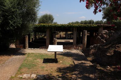
House of Birds
Within the same block as the houses previously described, a third house was also investigated, the Casa degli Uccelli, which owes its name to the wall decoration, with red, white and brown birds perched on vine shoots.
Necropolis
At Cosa the areas designated for burial have yielded funerary evidence that dates back to between the 3rd century BC. (Hellenistic age) and the 4th century AD. (late antiquity). The necropolises were located to the east, along the road that led to the port, and to the north-west, along the road that led from Cosa to the port of Feniglia. In the eastern necropolis there are funerary monuments in the form of a small temple in antis (Magna Graecia model), presumably datable to the beginning of the 2nd century BC; the area downstream hosts the E/1 mausoleum, a monument which establishes the use of new architectural schemes for funerary and non-funeral monuments, and which affects Cosa between the 2nd and the beginning of the 1st century BC. The sepulcher has a cubic base on which stands a rectangular prism structure with concave sides; it must have been faced with sandstone slabs with stucco mouldings. On the other hand, the attestations coming from the North-West necropolis date back to the early imperial age; the area houses the mausoleum N/1, some remains of a monument, earthen burials and the Santi columbarium. The latter dates back to the 1st century BC. and has a roughly quadrangular plan; it was built in opus cement with a brick facing. Inside the columbarium there are niches that were supposed to contain the cinerary jars. Capuchin tombs (with brick roofs arranged in a gabled position) of inhumated and incinerated persons dating back to the end of the 1st-beginning of the 2nd century AD were also found immediately outside the north-west gate. Particular interest aroused the capuchin tomb which housed the remains of a young girl, preserved and exhibited in the National Archaeological Museum of Cosa. The bones showed pathologies that seemed to be attributable to malnutrition (such as short stature, osteoporosis and hypoplasia of the dental enamel), but the girl was accompanied by a rich trousseau which included gold and bronze jewels, an indicator of a high social status. For this reason, a generic metabolic disease was first hypothesized, later recognized as celiac disease thanks to DNA analysis.
Two funerary monuments also flank the Provincial Coastal Road: the so-called. columbarium and the monument of San Biagio, dating back to the first half of the 2nd century AD.
Port areas
At the time of its foundation, Cosa represented for Rome the northernmost maritime settlement as, on the other hand, Paestum in the south. The colony had two port areas, the Portus Cosanus and the Portus Feniliae. The first is located to the south of the Cosano promontory, the second to the north. The Port of Feniglia was used, since the Republican era, for fish farming. There were processing plants and a living area. The Portus Cosanus is located near the Spacco della Regina and has been investigated more thoroughly than that of Feniglia; revealed three phases of use, starting from the foundation of the Latin colony in the 3rd century BC, up to the 3rd century AD. For the first period (3rd century BC – end of the 2nd century BC) no structures have been found; however, the testimony of a florid commerce is confirmed by the large quantity of fragments of amphorae, probably referring to the ceramic factory of the Sesti, a gens of the nobility of Rome who, according to Cicero, owned a villa in Cosa and were engaged in the wine trade and in the production of special transport containers (the mineralogical investigations carried out on the ceramic mixture have reported an almost certain origin of the containers from Cosana). A large number of amphorae are stamped SES, therefore referable to the aforementioned gens. Legislation of the 2nd century BC which prevented the Gauls from planting wine crops, favored the Italian production and trade of wine, and consequently the port of Cosa. Evidence of the attendance of the lagoon behind it is given to us by a small temple dated to the second quarter of the 2nd century BC. and dedicated to Poseidon/Neptune. It is a small Italic temple with a cell with clay decorations among which a warrior bust was found, now preserved and exhibited in the National Archaeological Museum of Cosa. Significant is the fact that this divinity was associated with the Domitii Enobarbi family, owners of a vast plot of land in the Cosa area. Furthermore, the discovery of an amphora stamped SEX DOMITI suggests a joint control of the ceramic production of the Domitii and Sesti in the Cosana area. In the lagoon area there was probably a fish farming facility. The peak of trade occurred between the 2nd and 1st century BC, when the port became a production-emporium complex with fishing port and wine and garum export activities. Through the profits of exporting wine, the Sestis have apparently transformed a simple fish processing into a large-scale industry for the export of garum; this is confirmed by Strabo (Geography, V.2.8) who gives us news of a fishing industry in Cosa. The concrete structures of the port and fishpond date back to this moment: the five piers, the bridge, the platform at the Tagliata Sud, the fish tanks in the lagoon, the platform of the Spring House, and the pillars of the aqueduct. A lighthouse probably stood on one of the piers.
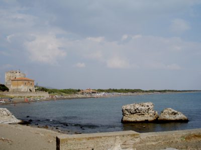
The back lagoon in this period was equipped with infrastructures such as water recirculation canals, among which the largest is the Tagliata canal, which allowed the control of the water flow and the creation of tanks for catching fish. The port was, unlike the city, rich in fresh water springs exploited through the construction of the Spring House, a building from which part of a wooden machinery for drawing water and placing it in the aqueduct comes. Starting from the imperial era, the port of Cosa underwent a significant contraction: the causes can be traced back to the silting up and the decrease in commercial exchanges, given the shift of Rome’s attention to eastern trade. One hypothesis is that the Sesti factory was destroyed following the owner’s support for the cause of the Cesaricides. During the 1st century AD a seaside villa was built on the site – the Villa della Tagliata – and a building was built on the Spring House for the collection of water, probably to supply the thermal plants. The new Spring House was destroyed by fire around 150 AD. The maritime villa, with a rectangular plan, had a monumental entrance, a tower and a thermal complex. Completed in the mid-2nd AD. within a project of imperial will, it was to combine residential functions with port and production ones. The villa, which has hardly been investigated at all, lies below a 14th-century watchtower. Rutilio Namaziano, during his journey, made a stop in Porto Ercole as the ports of Cosani were no longer practicable. In fact, the villa, restructured in the 3rd century AD, survived until the middle of the 5th century AD.


