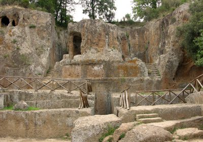
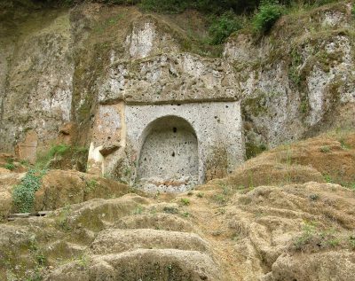
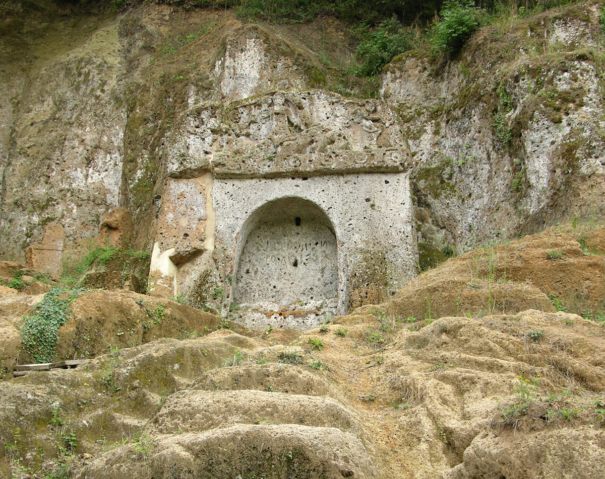
Established in 1998 with the aim of bringing together the main archaeological tourist resources of the municipal area of Sorano under a single jurisdiction, it includes the Sovana necropolises of Poggio Felceto, Poggio Prisca, Poggio Stanziale and Sopraripa, the Vie Cave of Sovana, the rock settlements of San Rocco and Vitozza. The access gates to the park are located at the documentation center of the Sovana museum pole, at the reception center of the archaeological area and at the museum of the Middle Ages and the Renaissance of the Orsini fortress in Sorano. Since 2004 it has been part of the provincial museum system “Musei di Maremma”.
Routes
The necropolis of Sovana is divided into numerous sectors scattered around the town. The two sectors that are included in the archaeological park are those to the west of the village: the first includes the via cava del Cavone, Poggio Felceto, Poggio Prisca and Poggio Stanziale, north of the Calesine ditch and along the Picciolana stream; the second includes the via cava di San Sebastiano, the necropolis of Sopraripa and the monumental tomb of the Siren, south of the Calesine ditch and along the Folonia stream.
First sector
The first sector of the Sova necropolis is crossed by the via cava del Cavone, a path excavated in the tuff dating back to the Etruscan period, so called due to its monumentality and its gigantic dimensions. Along the way it is possible to see a medieval niche once containing the devil chaser, a sacred image to protect wayfarers, and an inscription on the tuff with the Etruscan noble «VERTNA». Not far away, you can see an engraving in the shape of a swastika, a stylized representation of the sun. At the entrance to the Cavone, in 1912, Francesco Merlini found a votive deposit made up of numerous terracotta statuettes, human and animal heads, anatomical parts, now kept in the museum of San Mamiliano in Sovana.
Starting the route from the car park located along the provincial road that leads to San Martino sul Fiora, the visitor can first take the path on the left, which leads to the hill of Poggio Prisca, where two monumental Etruscan tombs are located. The Pola Tomb, located next to a large cavern with the remains of ancient rock structures, dates back to the 3rd century BC. and it was a temple-type burial once characterized by eight columns placed on a podium, of which only one remains today; under the temple is the dromos, fifteen meters long, which leads inside the burial chamber with a cruciform plan. The Tomb of the Winged Demons is located not far away and was discovered in 2004: it is a tomb with an aedicule carved into the tuff in which a deep central compartment was created in which the polychrome statue is carved of a deceased lying down holding a cup; on the two sides were instead carved two female winged demons – today only the one on the left remains visible, which carries a torch and is identifiable with Vanth – while on the pediment a winged sea demon and on the façade two sculptures of animals – the one on the left remains today , which depicts a lion.
After going back, take the path that leads to Poggio Felceto, where the famous and monumental Ildebranda tomb is located. Excavated and brought to light in 1924, it was baptized in honor of the Sovanese pope Ildebrando, known as Gregory VII. It looks like an imposing colonnaded temple, of the Etruscan-Italic type, dating back to the 3rd century BC, with a high molded podium that can be reached via two lateral staircases; the funerary chamber, accessible via a long dromos, has a cruciform plan with a watershed ceiling, while a second chamber with a coffered ceiling is accessible via another corridor.
The visit to the first sector of the archaeological area of Sovana ends with the Tomb of the Typhoon, located on the hill of Poggio Stanziale. Dating back to the 4th century BC, it looks like an aedicule tomb with a decorated tympanum: the figure represented on the tympanum was identified by George Dennis – perhaps erroneously – with the sea monster Typhon, hence the name.

Second sector
South of the Calesine ditch there is another archaeological area, again referable to the necropolis of Sovana, about two hundred meters from the first sector. You reach the church of San Sebastiano, of medieval origins, and from here you enter the via cava di San Sebastiano, an ancient Etruscan road excavated in the tuff that led to other necropolises located in the localities of Tollena, Piancostanzi and Poggio San Pietro. Various apotropaic signs are engraved on the rock to ward off evil spirits. Taking another path, along the course of the Folonia torrent, from the church you arrive at the necropolis of Sopraripa, characterized by numerous semi-dado and false-dado tombs from the second half of the 3rd century BC, obtained from the tufaceous wall, as well as chamber tombs dating back to earlier periods .
However, the most interesting monument of the necropolis is the monumental tomba della Sirena, also known as della Fontana, an aedicule tomb dating back to the 3rd century BC, characterized by the presence of an arched niche where the convivial bed is housed (kline ), while on the entablature Scylla, the sea monster, is depicted enveloping two cupids (erotes). The burial chamber, very small, was probably the sepulcher of only one person, that «Vel son of Vel» which can be read on the facade («Vel nulina Vel»).

San Rocco
The rock settlement of San Rocco is located near Sorano, on a panoramic terrace overlooking the Lente valley. The church of San Rocco is visible at the entrance. Just beyond the church, a path leads to the via cava di San Rocco, probably of Etruscan origin and dug into the tuff: the niches containing the devil chasers are interesting, apotropaic sacred images that had the function of driving away spirits malignant and protect wayfarers, and the ancient rainwater canalization systems. The area is also dotted with various Etruscan tombs , which attest to the use of San Rocco as a necropolis, while the remains of other structures document its medieval use as a residential centre.
Vitozza
The rock settlement of Vitozza is located north of the hamlet of San Quirico, about two kilometers from the town centre, and is one of the main rock settlements in Italy by extension. Documented starting from the 11th century, Vitozza was born as a castle which was part of a large feud together with Sorano, Pitigliano and other towns in the Viterbo area. After it became part of the Orsini County, there was a progressive abandonment of the castle nucleus and its defensive structures for still unknown reasons, which subsequently caused a very long and inexorable decline: the inhabitants began to migrate to nearby locations, also giving life in the adjacent village of San Quirico during the 16th century. In 1783 the Lorraines took a census of the resident population; at the entrance to some caves there is a descriptive panel which also indicates the names of the people or families who lived there at the time of the aforementioned census. The definitive abandonment of Vitozza occurred at the end of the XVIII century.
The medieval settlement must have been of particular importance, since the remains of numerous fortifications, churches, houses, stables and outbuildings have been found here, as well as more than two hundred caves dug into the tuff which testify to the presence of the territory already in ancient times. Scholars have divided the caves into three types, based on their use: caves for residential use, characterized by the presence of wells for collecting water, remains of flues, ziri for grain; stables, characterized by the presence of mangers and enclosures; caves for mixed use, both for housing and as a stable.


