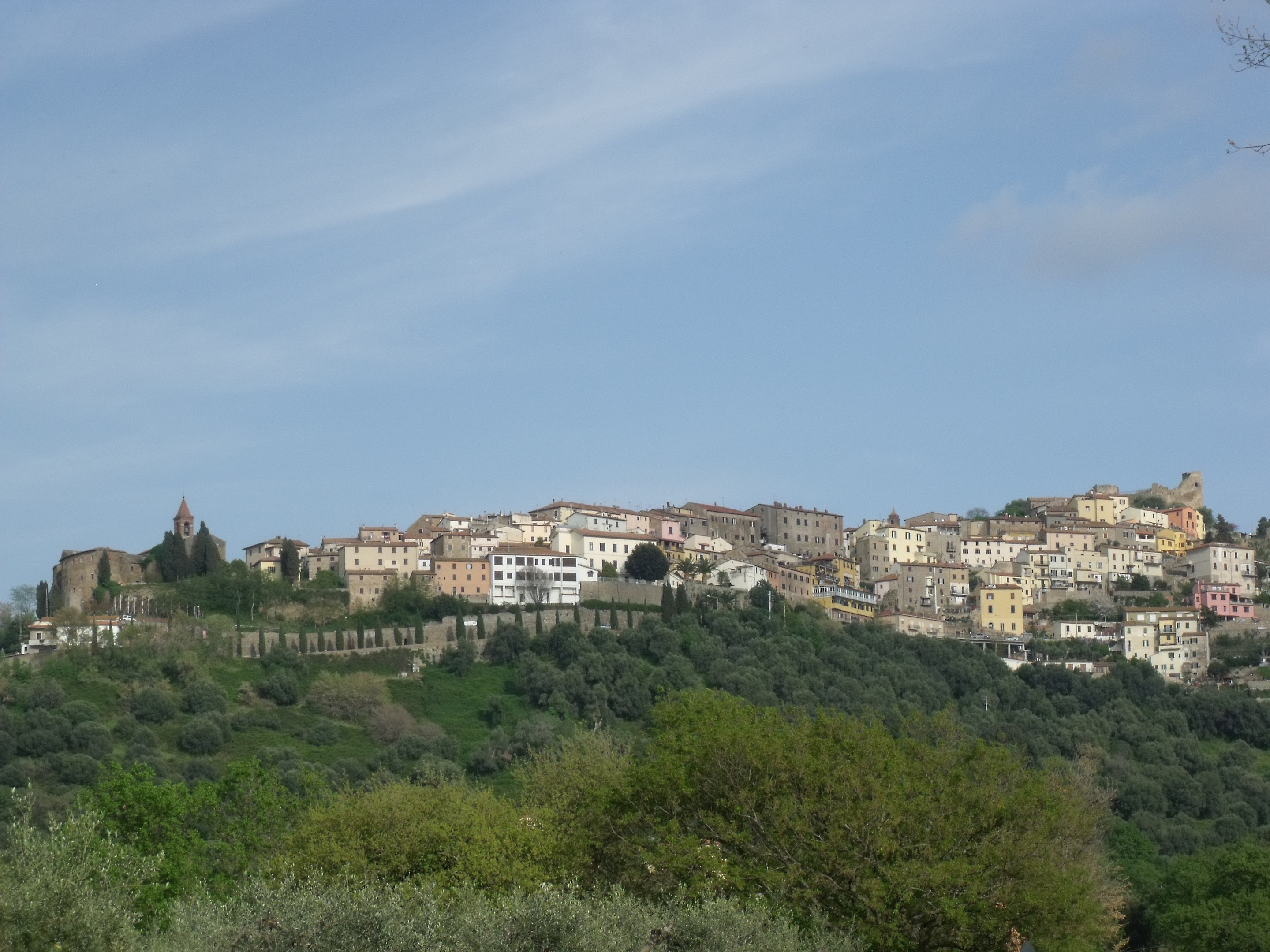
The municipal territory extends from the north-western slopes of Poggio Ballone to the high and jagged coastal strip of the promontory of the Bandite di Scarlino, a protected area within which the suggestive Cala Violina and Cala Martina stand out. To the north of the promontory is Porto del Puntone, in the heart of the seaside village of the same name.
It seems that the territory of Scarlino was already inhabited in prehistoric times: this is testified by findings near the Rocca Pisana dating back to Bronze Age. Other finds from the Hellenistic age (4th-2nd century BC) prove that there already existed some settlements prior to the development of the early medieval village, while the discovery along the coast (Puntone, Portiglioni) of buildings and a port from the Roman era confirms the presence of lively commercial activities even before the Middle Ages.
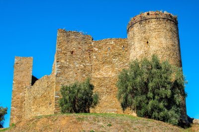
•Rocca Pisana, (the Aldobrandeschi fortress, also known as Castello di Scarlino) built during the 10th century and mentioned for the first time in a document dated 1108, was sold in the 14th century to the Pisans, who completely restructured it. When the fortress passed to the Appiani in the 15th century, they carried out further expansions. Between 1979 and 1983, in addition to the restoration work, excavation campaigns were undertaken which made it possible to bring to light numerous masonry structures, including those identifiable with the ancient parish church of Santa Maria*; in addition to this it was possible to ascertain the presence of Hellenistic masonry of the IV-II centuries BC. and settlements dating back to the Bronze Age, which testify to a attendance of this place since prehistoric times.
It is located in a dominant position with respect to the town, the southern area of the Grosseto Metalliferous Hills and the northern part of the Grosseto Maremma; it appears in the form of imposing ruins, covered in stone, recovered thanks to the restoration work carried out in the last two decades of the twentieth century.
The current complex, dating back to the late medieval restructuring, consists of three corner towers different from each other, joined together by a series of curtain walls of different heights. The north-eastern tower has a circular section, with a round arched door; around it are the remains of curtain walls which must have enclosed, in the past, a bastion or a fortress. The south-eastern tower has a square section, while the south-western one is rectangular and shorter than the others.
•Rocca Pisana archaeological area: outside the fortress towards the town, the excavations conducted between 1979 and 1983 are still partially visible by the medieval archeology department of the University of Siena, with wall fragments from the buildings destroyed at the end of the 13th century to build the ravelin, the area in front of the fortress then under construction. Visible on the way towards the inhabited center are the perimeter of the ancient church with the pre-existing early medieval remains and the subsequent adaptations of the Romanesque and Renaissance periods.
•Poggio Tondo archaeological park: near Pian d’Alma, some excavations carried out starting from the eighties of the twentieth century allowed the discovery of a necropolis with four tumulus tombs (called tomb of the Drum, tomb of the Cart, tomb of the Cippus and tomb of the Two Doors), datable from the mid-7th to the mid-6th century BC, as well as an building isolated from identified as a farm, in use until the end of the 6th century BC.
*The parish church of Santa Maria was a religious building of early medieval origins, the church was built near the original fortified settlement. The place of worship, whose certain existence dates back to at least the 9th century, was restructured in Romanesque style during the following centuries, resulting in it being an autonomous parish church in the Rationes Decimarum of the late 13th century. Subsequently, the religious building experienced a period of deterioration which led to its reconstruction in the fifteenth century. After a new temporary period of splendor in the Renaissance, the church was definitively abandoned, resulting already lost during the eighteenth century.
The remains of the parish church of Santa Maria are visible in the area in front of the Rocca aldobrandesca which, inside the walls, faces the medieval historic center of Scarlino. Recently brought to light by a series of excavations, the church had a rectangular plan with a single nave and a semicircular apse; internally it was decorated with a series of frescoes dating back to the early Middle Ages.
Museums of Scarlino
• The Local Documentation Center Riccardo Francovich, inaugurated in 1994 to document the experience of the excavation campaigns carried out at the Rocca Pisana from 1979 to 1983, under the direction of Professor Riccardo Francovich, which made it possible to bring to light many wall structures referable to a very historical period vast ranging from the Bronze Age to the 17th century: remains from the 12th-10th century BC have been found, Hellenistic walls from the 4th-2nd centuries BC, an early medieval settlement (7th-10th century), consisting of wooden huts and a small church – the ancient parish church of Santa Maria* – and subsequent modifications (15th century). In 2007, with the sudden death of Riccardo Francovich, the museum was named after him.
The museum has three small exhibition halls which document the various periods in the Rocca Pisana area through finds found during the excavation campaigns. The first two rooms contain, in addition to explanatory panels illustrating the history of Scarlino and the fortress, five display cases.
The first showcase exhibits some finds from the most ancient periods, while the second showcase exhibits ornamental objects from the modern age.
Three other showcases exhibit a vast collection of ceramics dating back to a long period between the 9th and 18th centuries. The first collects older pottery between the 9th and 13th centuries; up to pottery from the 14th and 15th centuries. The second exhibits ceramics from the 15th and 16th centuries. The third exhibits ceramics from the 16th to the 18th centuries.
The third room, the smallest, contains the so-called treasure of Scarlino, consisting of one hundred gold coins dating back to around the fourteenth century and found in a niche of the old parish church of Santa Maria inside a jar. The coins come from seven different mints. In the same room, some panels document the researches carried out starting from 2005 in Vetricella, where the presence of the Castellina customs castle was proven , attested in the IX-XII centuries.
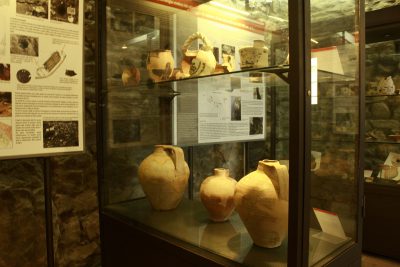
• Documentation center of the territory for the Etruscansis an archaeological museum, inaugurated on 22 May 2009 to document the presence of the Etruscans in the municipal area of Scarlino, following the excavations that brought to light the archaeological area of Poggio Tondo, in the Pian d’Alma area.
The documentation center has been set up inside an old cellar of a building of medieval origins, which belonged to the Guelfi family until the last century.
The small museum is divided into two rooms equipped with explanatory panels:
The first room documents the Etruscan occupation of the entire municipal territory of Scarlino: the burial area of Poggio Tondo, the Poggio Tondo farm, the Alma Valley, Puntone, the Scarlino fortress. In the center of the room the main piece of the museum is exhibited: a piece of bronze horse mount found in the area of the ruins of the rectory of San Michele, in the plain at the foot of the village of Scarlino.
The second room exhibits, inside four display cases accompanied by illustrative panels, the artifacts found in the four tombs of the Poggio Tondo necropolis area >, datable between the mid-7th century and the mid-6th century BC, an ancient center under the control of the Etruscan city of Vetulonia.
The Tomb of the Drum, so named for the presence of a stone structure that circumscribes the base of the tumulus, has unearthed various objects related to the toilet and to clothing, some decorated aryballoi, metal weapons (axes), and other finds referable to the Hellenistic and medieval age. The Tomb of the Cippo owes its name to the capped funerary cippus that originally crowned the tumulus: the finds can be traced back to two different burials and have been brought to light numerous objects referable to the symposium, such as vases of various kinds in bucchero, and others to personal ornament (containers for cosmetics, pyxes, ointment jars). Even the tomb of the Two Doors, so called due to the two slabs that delimited the space of the female burial, has preserved some objects symposium (bucchero vases), for toiletry and personal ornament, but also remains of weapons. Finally, the finds found in the Tomb of the Chariot are on display, the most atypical of the burials, which has a large space in the center of seven meters by two where a chariot was also placed as a symbol of prestige for the deceased, probably a warrior with rich equipment: numerous objects referable to the symposium have been found, but also above all weapons and other signs of aristocratic rank; a late medieval attendance has also allowed the discovery of a pot of raw clay.
•The Archaeological Museum of Portus Scabris (MAPS) is a museum located in the Puntone hamlet.
During the works for the construction of the tourist port at Puntone di Scarlino, between 1999 and 2003, numerous underwater archaeological evidences were immediately brought to light. Thanks to a series of underwater operations it was possible to find, catalog and study various finds attributable to different historical periods, thus documenting the history of an ancient landing place, that of Portiglioni bay in the Gulf of Follonica, identifiable with the toponym of Portus Scabris.
The museum was set up between 2009 and 2010 with the aim of reconstructing, through archaeological finds, the history of this ancient port of call frequented since the end of the 3rd century BC.
The museum is set up inside the historic hydraulic toll booth of Puntone, dating back to 1905 and in the typical eclectic style of the early twentieth century, with art nouveau decorations.
The MAPS is divided into six rooms – five exhibitions plus a video room – arranged on the two floors of the historic hydraulic toll booth.
The first three rooms located on the ground floor of the hydraulic tollbooth illustrate through explanatory panels the history of the ancient vanished port of Puntone, as well as the port system of antiquity.
The third room, entitled “the port through the centuries: the exhibits tell the story“, intends to show the visitor some of the artifacts related to the port exhibited in twenty-nine showcases arranged in chronological order, from the 3rd century BC until the 20th century. The finds can thus tell the story of the port in its historical phases and bear witness to a certain vitality of the port (ceramics and glass objects from North Africa and the eastern Mediterranean).
Upstairs there are two other exhibition halls plus a video room, which projects a documentary on underwater excavations conducted between 2000 and 2001 during the construction of the modern port tourist.
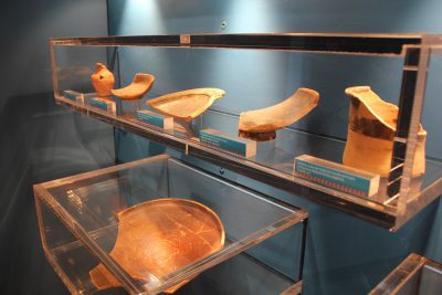
The fourth room is dedicated to ancient navigation, illustrating through panels the types of ships that reached the Roman port, the stowage systems and the shipboard life on merchant ships. The display in this room of a homogeneous group of transport containers recovered on the seabed of the port is interesting: a collection of wine amphorae of the Greek-Italic type. Among the other exhibits there are some on-board instruments such as a depth sounder, some nails, awls, net needles, but also various tiles for covering the aft cabins, and interesting pots, pans and olle still blackened by fire used by sailors to prepare meals.
In the fifth and last exhibition hall an installation has been set up that reproduces the formation of the archaeological site on the seabed of the port, with the oldest phase at greater depths, covered in centuries from sand and other materials. The room in question reconstructs the archaeological stratification of the two best documented ancient phases, those of the middle and late republican age.
Phase 2 refers to the first frequency of the port, between the end of the 3rd and the beginning of the 2nd century BC, which allowed the discovery, in the deepest layers, of Greek-Italic wine amphorae and black-glazed ceramic pottery of Campanian and Etruscan-Lazio production, quite homogeneous, probably part of the same damaged load thrown into the sea during a stop.
Phase 1 instead refers to the period in which the attendance of the port intensified with commercial routes towards the whole Mediterranean and towards the island of Elba, thanks to the growing importance of Portus Scabris as an iron and steel center (2nd-1st century BC): here the stratification is more chaotic, but has led to the discovery of numerous artefacts, such as amphorae, tableware in Campanian and Etruscan-Lazio black paint, glasses with thin walls, tools, ship’s tools, animal remains, and above all ferrous material of Elba origin.
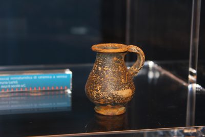
During the excavations numerous pots were also found, all displayed in showcases; however, among the most interesting finds, an olpe (jug) from the 2nd century BC stands out. still preserved intact after more than two thousand years.
Scarlino also has two protected natural areas:
•Scarlino Nature Reserve, a protected natural area established in 1977, occupies an area of approximately 50 hectares on the crest of Poggio Spedaletto, which overlooks the Gulf of Follonica.
The reserve is dominated by the presence of Mediterranean scrub and a pine forest of domestic pine, planted artificially.
•Marshes and Costiere di Scarlino, a protected natural area established in 1976 and a site of community interest in the province of Grosseto, occupies a vast area of 752 hectares and includes inside part of the so-called Bandite di Scarlino, a large coastal wooded area which also flows into the municipalities of Gavorrano and Castiglione della Pescaia, and the coves overlooking the Tyrrhenian Sea: the bay of Portiglioni, Cala di Terra Rossa, Cala Le Donne, Cala Martina, Cala Violina and Cala Civette.
The prevailing environmental typology in the SIR is given by one of the residual coastal wetlands of southern Tuscany, which is of considerable importance for the rest, wintering and nesting of birds in particular for conservation strong> of some rare and endangered nesting species such as the bittern, the marsh harrier and the chestnut warreer. Note the presence of martens.
The coastal marsh area is largely freshwater (with a prevalence of reeds), with a significant brackish portion, where bulrushes prevail and glasswort. In the area there is a nesting population of chestnut warblers, of considerable interest, as it is the only population in southern Tuscany. The area is important for the rest and wintering of aquatic birds. There are also different mammals: wild boar, fox, weasel, stone marten, porcupine, badger and hedgehog. Among the insects there is the Callimorpha quadripuncatata.
Among the plant species present in the SIR: Artemisia coerulescens var. palmata, a very rare species in Tuscany, reported in the salty meadows of the Maremma Regional Park and the Palude di Scarlino. In addition there are also prickly juniper, glasswort, holm oak and stone pine, due to the nearby pine forest.


