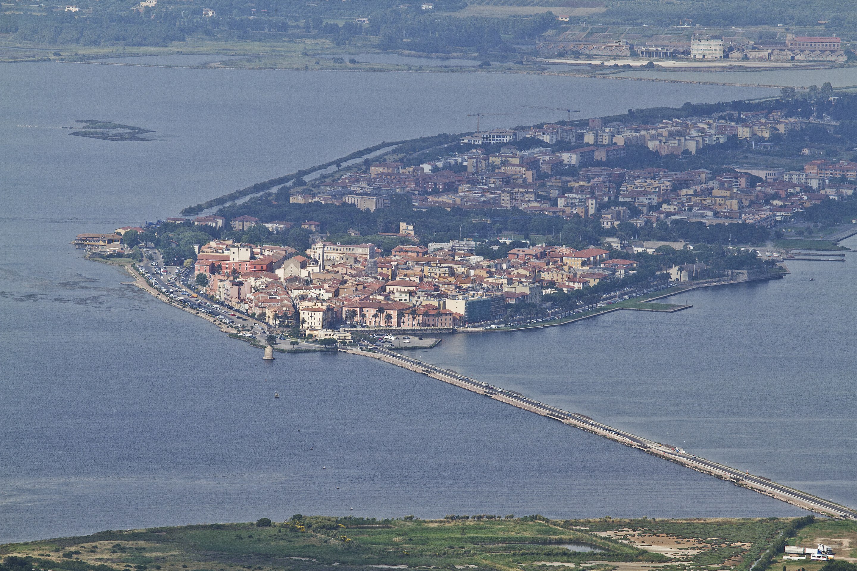
The city of Orbetello rises in the middle of the homonymous lagoon and is joined to Monte Argentario by a road built on an artificial embankment (the dam), which has divided the lagoon into two stretches of water (“Laguna di Levante” and “Laguna di Ponente”). Until 1944, a railway also ran on the dam which connected it to Porto Santo Stefano.
The municipal territory is extremely varied; the lagoon wetland is bounded towards the sea by two tomboli, the Tombolo della Feniglia and the Tombolo della Giannella, characterized by long sandy beaches, pine forests and Mediterranean scrub. The coast near the reliefs of Talamone and Ansedonia it becomes rocky and difficult to access.
The inland is characterized by modest reliefs, where the vegetation grows spontaneously, forming intricate spots, and by flat areas, once malarial and today intensively cultivated.
The territory of Orbetello has been frequented since the Etruscan period, when it had to fulfill a function of seaport along the routes that connected the northern Etruscan cities with the more southern ones, such as Vulci and Tarquinia, and assumed particular importance even during the domination of Rome , who founded the colony of Cosa, near Ansedonia.
Places of interest:
•Spanish mill, sole survivor of the nine Sienese mills, built in the lagoon during the 15th century. In the past it exploited the power of the water to grind the grain which was brought to the mills through the “barchini”, typical boats used in Orbetello in the lagoon. The mill, restructured and consolidated by the Spaniards – hence the name – has a circular shape with a conical roof and rear wind propeller.
•Walls of Orbetello: of Etruscan origins (probably datable to the 5th century BC), they were enlarged and restored first in the Middle Ages and then at the end of the 16th century. The Spaniards strengthened them by building on the land side the imposing bastion line of which the two city gates, the imposing fortress and partly two ravelins are still visible.
•Orbetello lagoon oasis, created and managed by the WWF as a “wetland of international interest”, represents one of the most important Italian wintering areas for many bird species. The Orbetello lagoon is a stretch of sea between two coastal strips that connect the Argentario promontory to the mainland. It has an area of 26.22 km².
•Forte delle Saline, located in the hamlet of Albinia, it is a fortified structure built by the Sienese in the 15th century (the project dates back to 1469), modified and strengthened by the Spaniards in 1630. The fort was used to control the adjacent salt pans, an important resource of the area, but also the river stopover of the Albegnaa and the passage over the tombolo of the Giannella. It is currently public property and is used as an archive by the Superintendence.
In Ansedonia you can find:
•Tagliata Etrusca, a remarkable engineering work dating back to the Etruscan-Roman period. It is a channel cut into the rock along the southeast coast of the promontory, designed to avoid silting up of the ancient port by creating a system of counter-currents coming from the sea and from the effluent channel of the nearby Burano lake.
•Spacco della Regina, large crack in the promontory above which develops along some artificially dug tunnels.


