The municipal territory of Sorano extends in the eastern part of the Tufo area. It borders to the north with the municipality of Castell’Azzara, to the east with the Lazio municipalities of Acquapendente, Proceno, Onano and Latera, to the south with the municipality of Pitigliano, to the west with the municipalities of Manciano and Semproniano.
The municipal capital is located 379 m above sea level. on a tuff cliff which, from the east, dominates a stretch of the course of the river Lente; it is located in the center of a territory that develops mainly at hilly altitudes, albeit interspersed with basins and reliefs. The lowest altitude is recorded in the Pianetto di Sovana, near the locality of the same name, with altitudes around 270 metres, while the highest altitudes, of mountain type, are recorded on the summit overlooking the hamlet of Montevitozzo (926 meters above sea level). and on Monte Elmo (829 meters above sea level), two reliefs that clearly interrupt the hilly landscape.
The main rivers are the Fiora, which borders the municipal area to the west, flowing from north to south, and the Lente river, its left tributary , which has its sources in the municipal area of Sorano. The minor watercourses, including the Stridolone, are more torrential in nature.
A series of thermal springs, known as Terme di Sorano, bubble up along a flowing stream about 3–4 km south of the centre.
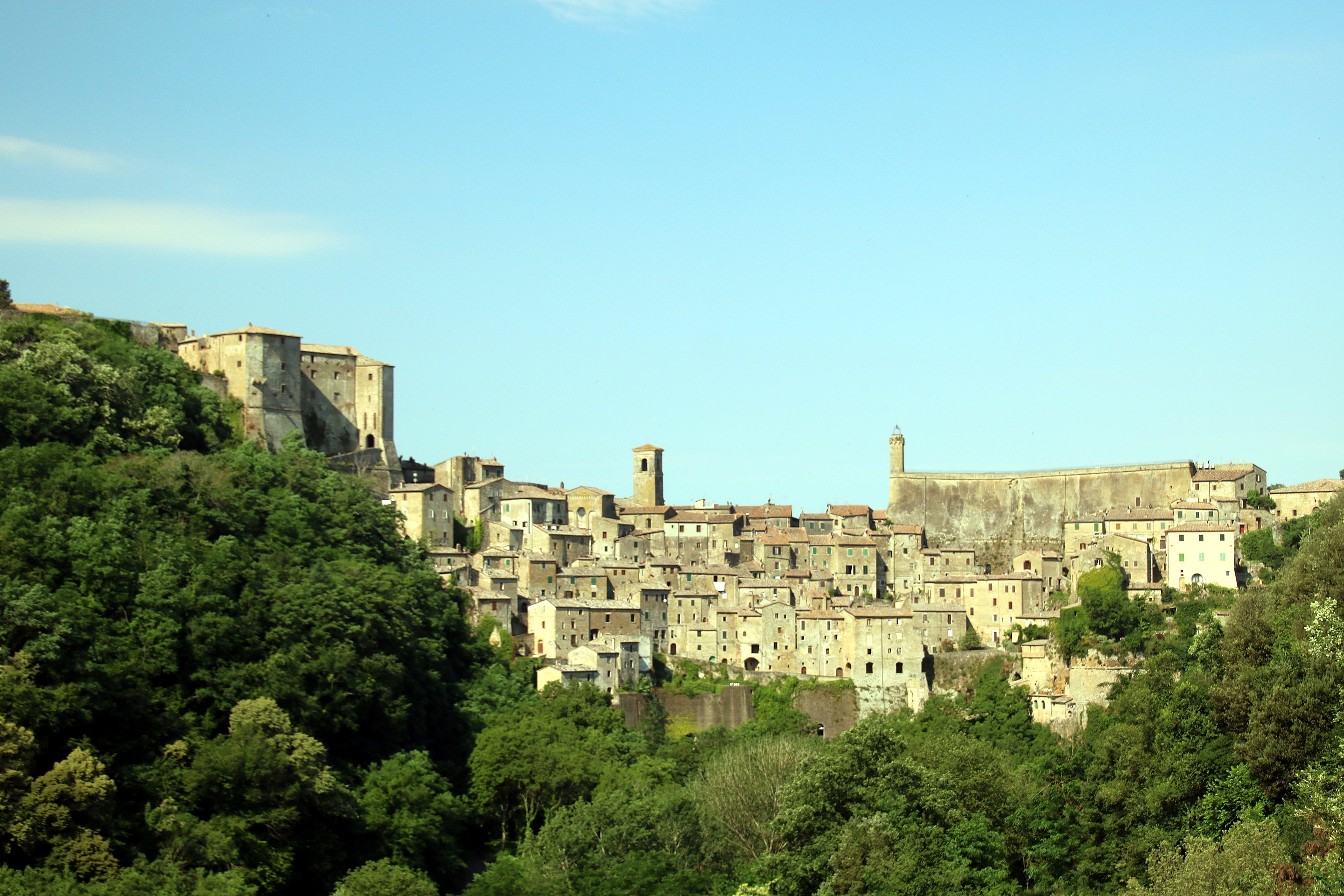
The town of Sorano is perched on a steep tufaceous cliff which has various gradients. The village is also characterized by a labyrinth of alleys, courtyards, arches, ashlar portals, external staircases, loggias and cellars dug out of the tuff where in the past the various phases of the harvest. Around the historic center, Sorano has a small urban area, which developed in an orderly manner starting from the sixties of the 20th century thanks to regulatory urban interventions. From an urban-architectural point of view, we note the area 167, built in tuff and commonly called with the name of New Houses, an attempt to merge contemporary architecture and modern needs with the tuff environment and an ancient context well-established: the district was built between 1969 and 1976, among the most important buildings is the condominium-tower in viale Brigate Partigiane, as it is the most representative of the modern architectures that form the skyline of Sorano.
•Orsini Fortress built on the site of the ancient Aldobrandeschi fortress – it was completed in 1552, as evidenced by a plaque placed on the access portal. Imposing fortification capable of withstanding the longest and most exhausting sieges, it is composed of a central keep with the parade ground, connected by ramparts to two bastions, dedicated to San Marco (east) and San Pietro (west) in honor of the two cities to which the Orsini were most closely linked: Venice and Rome. In the 19th century some modifications were made to the structure and a part of the walls was demolished to allow the construction of the imposing Palazzo Ricci Busatti, then owned by Ilari and today a linguistic high school. Important restoration works were carried out starting from 1967. Since 1996, it has housed the museum of the Middle Ages and the Renaissance in its rooms.
•Città del Tufo archaeological park, archaeological area which it extends over a vast area between Sorano and Sovana. It includes various Etruscan necropolises scattered throughout the territory and connected to each other by a suggestive coeval road network which develops in a trench between steep rocky tuff walls: these roads are called Vie Cave or Cavoni.
•Vitozza: ancient city in the form of a rock settlement strong>, located in the municipal area of Sorano, a couple of kilometers north-west of the town of San Quirico. The settlement was built in the Middle Ages as a castle and, after its definitive abandonment in the late 18th century, the remains of the two fortresses, a parish church and the characteristic rock settlement are preserved, as well as a group of numerous “columbariums”.
•Castello di Montorio, located in the hamlet of Montorio, is found in an angular position along the walls. It preserves some parts of the original medieval structure.
Castell’Ottieri:
Built in the Medieval Ages as a sub-feud of a valvassor of Germanic origins, the place later became a possession of the lords of Montorio and, in the second half of the 13th century, passed under the control of Orvieto. Subsequently, it was conquered by the local Ottieri family who made it the main center and the undisputed capital of their small county.
The Ottieri controlled the centre, apart from a temporary submission to Siena in the fifteenth century, until 1616, the year in which the feud was sold to the Medici who incorporated it into the Grand Duchy of Tuscany.
In the second half of the 18th century, the Lorraine reform law included Castell’Ottieri in the municipal territory of Sorano.
Monuments and places of interest
•Church of San Bartolomeo, the parish church of the hamlet, was built at the end of the 16th century by Sinolfo Ottieri, treasurer of Sixtus IV. Interesting artistic works are kept inside: we recall a Madonna in glory between saints Bartholomew and Nicholas of Bari, dated 1590, and a cycle of frescoes attributable to the Nasini school.
•Church of Santa Maria, built during the 17th century, it was originally an oratory, later restructured in the late 19th century. Inside there are some fresco decorations and a table.
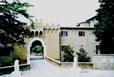
•Rocca degli Ottieri, built in the Renaissance period by the Ottieri family around the pre-existing Aldobrandeschi fortress. The fortress develops on three sides and is characterized by a tower with a circular section; the walls branch off to the sides where the gate for access to the village opens. The entire complex has wall structures in tuff while the coats of arms are in travertine.
•Rocca di Montevitozzo, or La Roccaccia, is located in the north-western part of the municipal territory of Sorano. Built in the Middle Ages as an ancient castle of the Aldobrandeschi family, Montevitozzo later became an object of contention between the Ottieri di Montorio, linked to the Aldobrandeschis, and the Orvietani who aimed to expand their domains in the south-eastern part of the current province of Grosseto.
At the beginning of the seventeenth century, Montevitozzo passed into the hands of the Medici who incorporated it into the Grand Duchy of Tuscany.
The fortification currently takes the form of imposing ruins which, from the peak of the same name, dominate a large part of the territory of Sorano and Castell’Azzara.
The partial remains of a double wall are clearly visible, where the external walls are articulated around the ridge, while the internal ones enclose the quadrangular area where the fortress proper stands; of the ancient fortress only the mighty stone base with a square section of a structure that must have been the watchtower remains.
•The castle of Montorio is a fortified structure, built in the Middle Ages as an Aldobrandeschi fortress, and was one of the many possessions that the noble family had in the area. However, already during the thirteenth century, the Aldobrandeschi family gave the complex in usufruct to the Ottieri, local lords among whom Count Bartolomeo is remembered. Passing into the grand ducal territory, the castle was sold to private individuals and transformed into a fortified farm.
The structure is articulated in an “L” shape, the vertex of which is made up of a lowered tower with a circular section which coincides with the south-eastern corner of the walls which delimit the village. The walls are entirely covered in tuff ashlars and, on the outside, coincide with a short section of the curtain wall; some stylistic elements of the medieval period are preserved despite the subsequent renovations.
Inside the village, the two buildings of the castle border a courtyard where the well is located, which in the past functioned as a cistern: the latter is decorated with some mirrors that were originally located in the castle of Sopano.


